
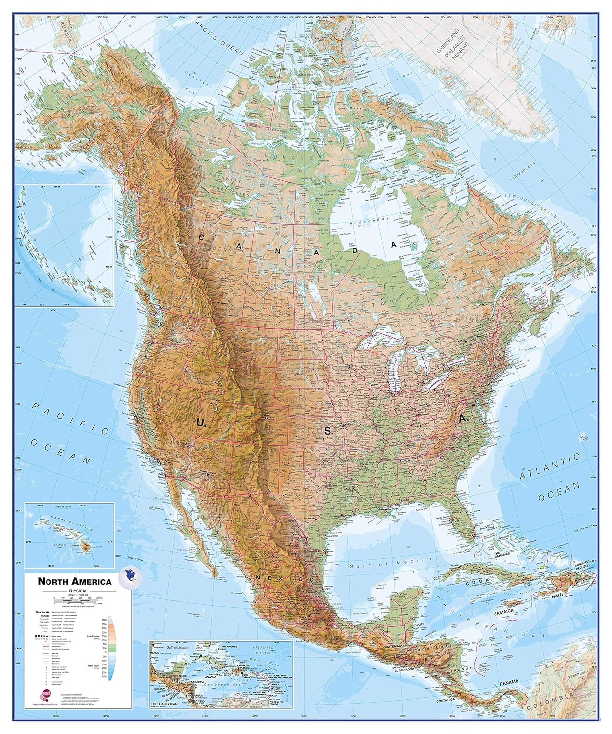
Maps International Large Physical North America Wall Map - Paper - 47 x 39
Product details
| Management number | 211998997 | Release Date | 2026/04/06 | List Price | US$36.00 | Model Number | 211998997 | ||
|---|---|---|---|---|---|---|---|---|---|
| Category | |||||||||
This North America physical wall map covers a huge expanse of land from Alaska and Canada through the United States down to Mexico, Central America and the Caribbean. North American Map Detail: This physical wall map of North America features the natural terrain of the land, with countries marked and international borders shown. The map's key helps to identify the land elevation and water depth. This North American physical wall map also contains city population detail, capital cities and all the major towns and cities in this continent of North America.Map Uses: Major motorways and transport lines are shown making it an ideal map for your planning and logistics needs in this American continent.Made from: This Physical North America Wall Map is printed on 48lb poster paper and left unfinished. Delivered rolled in a tube. Read more
Bestseller ranking
Vocal Effects Processors


Customers who viewed this product also viewed
Maps


Correction of product information
If you notice any omissions or errors in the product information on this page, please use the correction request form below.
Correction Request Form